Short answer
Oshima Airport is a strong island-airport day for aviation fans because Tokyo Metropolitan Government lists a free observation deck, the airport-use rules record a 1,800m x 45m runway, and New Central Airservice connects Oshima with Chofu by small turboprop aircraft. Build the day around the official deck, the Motomachi or Okata port choice, ferry alternatives, bus, taxi, rental-car, Mt. Mihara, Ura Desert, and weather-aware return planning.
Last checked: August 21, 2026. Flight operations, aircraft type, fares, reservations, airport services, observation-deck access, shop and restaurant hours, ferry sailings, arrival port, helicopter routes, bus timetables, taxi availability, rental inventory, volcanic-site access, weather, sea conditions, fog, wind, and typhoon disruption can change. Always confirm current details on official airport, airline, ferry, island-access, tourism, transport, and weather pages before travel.
Why Oshima works for aviation fans
Tokyo Oshima Camellia Airport is close enough to Tokyo to feel like a compact aviation side trip, but different enough to feel like island travel. Tokyo Metropolitan Government’s airport-services page lists an observation deck with free admission, while its airport-use rules record a 1,800m x 45m runway, multiple apron categories, and an ILS facility for the 03-side approach only. New Central Airservice describes its Izu Islands route network from Chofu and its Dornier 228 twin-turboprop aircraft, making Oshima a useful place to understand Tokyo’s island-air links beyond the major jet airports.
The key is to keep the plan public, legal, and light. Use the terminal, official deck, public roads, ports, buses, taxis, and rental services. Do not use fence lines, airport service roads, private land, drone flights, or roadside behavior that could disturb local traffic or airport operations.
Start with the terminal and deck
The airport-services page lists seasonal airport operating hours, restaurant and shop information, a smoking area, free parking, and airport access by car from Motomachi Port or Okata Port in about 10 minutes. The Tokyo Sightseeing Accessibility Guide adds the practical layout: airport company counters and vending machines on the first floor, restaurants and stores on the second floor, and the observation deck on the third floor.
That makes the airport a simple first anchor. Arrive early enough to check flight status, use the terminal, look at the deck when it is open, and decide whether your island branch should point toward a port, Mt. Mihara, Ura Desert, Oshima Park, a food stop, or a short scenic drive. The deck is the aviation focus, but the best Oshima day usually combines aircraft, port logistics, and one island landscape.
Compare Chofu flights with sea routes
Destination Tokyo Islands describes Oshima access by jet ferry from Tokyo Takeshiba, large ship from Tokyo Takeshiba, and plane from Chofu Airport, while Tokyo Islands also lists routes from Takeshiba, Chofu, Yokohama, Atami, and nearby islands. Tokyo Treasure Island Traffic Information presents Oshima as a place where air, high-speed jet boat, large ship, and helicopter movements all need current operation checks.
For an aviation fan, this creates three good formats. A flight-focused plan uses Chofu and Oshima Airport as the main experience. A ferry-and-flight plan compares the airport with Motomachi Port or Okata Port. A slower island plan uses one arrival mode and one return mode only if the current schedules, same-day operation, weather, and lodging plan support it. Do not assume the same port every time: sea arrivals may depend on the day’s operation, weather, and ship routing.
Choose local movement before you land
Oshima is easier when you choose island movement before arrival. Tokyo’s accessibility guide lists buses, taxis, rental cars, rental motorbikes, and rental bicycles as island options, and notes that bus schedules are determined close to the day of use. The Oshima Tourism Association also presents route buses, sightseeing buses, taxis, rental cars, rental bicycles, and rental motorbikes as practical choices.
A rental car gives the most flexibility for an airport-to-port-to-volcano plan, especially if you want to connect Tokyo Oshima Camellia Airport, Motomachi, Okata, Mt. Mihara, Ura Desert viewpoints, Oshima Park, or Habu Port. A bus plan can work, but it should be built around the current route and return timetable. A taxi plan should include dispatch and return movement. Bicycles and motorbikes need extra caution because Oshima is hilly, weather-exposed, and not a flat airport-neighborhood ride.
Add one volcanic-island branch
Tokyo Islands describes Oshima as the largest island in the Izu Islands, about 120km south of central Tokyo, with Mt. Mihara as an active volcano rising to 758m. The same tourism context highlights Ura Desert, camellias, coastal scenery, and the island’s volcanic landscapes. Tokyo Treasure Island Traffic Information also points visitors toward Mt. Mihara and Oshima Park as major branches.
For a first airport-area guide, choose only one branch. A transport branch compares the airport with Motomachi or Okata Port. A volcano branch goes toward Mt. Mihara or Ura Desert only when weather and official conditions are suitable. A food-and-town branch keeps the day lower risk around Motomachi, Okata, shops, restaurants, and short viewpoints. Oshima may look close to Tokyo on a map, but air, sea, mountain, and road plans all need buffers.
Simple first-time plan
| Step | What to do | Why it works |
|---|---|---|
| 1 | Check New Central Airservice, airport services, deck access, ferry status, port choice, bus timetable, taxi availability, rental reservation, volcanic-site conditions, and weather | Oshima plans depend on air, sea, road, and mountain conditions |
| 2 | Use the public terminal, free observation deck, 1,800m runway context, shop, restaurant, and parking notes as the aviation anchor | The airport is compact but useful for official aircraft viewing |
| 3 | Choose a movement base: airport, Motomachi Port, Okata Port, bus, taxi, rental-car, or ferry-and-flight comparison | Local movement shapes the whole day |
| 4 | Add one branch: Mt. Mihara, Ura Desert, Oshima Park, Habu Port, food, port logistics, or a short scenic drive | One branch keeps the trip resilient |
| 5 | Leave buffers before flight departure, ship boarding, rental return, bus connection, sunset, fog, wind, and bad-weather changes | Island travel rewards spare time |
Where this fits in the transport hub
Use this as the Oshima branch of the Japan Transport Fan Travel Guide. It pairs naturally with Hachijojima, Haneda, Chofu-related island flights, Niijima, Kozushima, Miyakejima, Fukue, Tsushima, Iki, Tanegashima, Yakushima, and other island-airport guides. Oshima stands out because a short Chofu flight, frequent sea-route decisions, a public airport deck, and an active-volcano landscape can all fit into one careful plan.
Photo credit
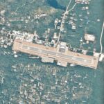
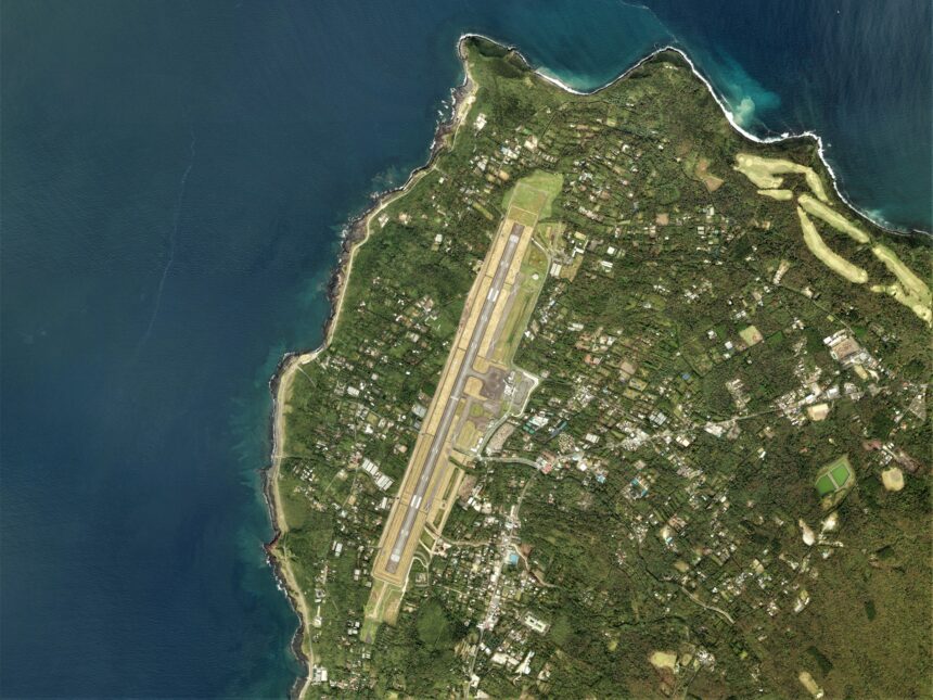
Featured image: Oshima Airport Aerial photograph.2016, by Geospatial Information Authority of Japan, made based on National Land Image Information (Color Aerial Photographs), Ministry of Land, Infrastructure, Transport and Tourism, via Wikimedia Commons. MLIT National Land Image Information permission allows use for any purpose with proper attribution. Cropping or resizing may be applied for site display. The image is used in editorial transport-travel-guide context and does not imply endorsement by MLIT, GSI, Tokyo Metropolitan Government, Oshima Airport, airport operators, airlines, ferry operators, tourism organizations, Wikimedia, or the uploader.
Sources
- Tokyo Metropolitan Government: Oshima Airport services
- Tokyo Metropolitan Government: Oshima Airport use rules
- New Central Airservice official site
- New Central Airservice: timetable and fare page
- Destination Tokyo Islands: access
- Tokyo Treasure Island Traffic Information: Izu Oshima Island
- Tokyo Islands: Oshima
- Tokyo Sightseeing Accessibility Guide: Oshima access and traffic
- Oshima Tourism Association: island transportation
- Wikimedia Commons image file and license record
Editorial disclosure: This is an independent planning guide. It is not affiliated with Tokyo Metropolitan Government, Oshima Town, Tokyo Oshima Camellia Airport, New Central Airservice, Tokai Kisen, Toho Air Service, Oshima Bus, taxi operators, rental companies, Oshima Tourism Association, Tokyo Islands, Destination Tokyo Islands, MLIT, GSI, Wikimedia, or the image uploader.