Short answer
Okinoerabu Airport is a good Amami Islands airport day for aviation fans because Kagoshima Prefecture’s official service page lists an observation deck on the airport terminal rooftop, while the airport page gives a compact 1,350m runway, seasonal operation hours, and parking rules. Use the official rooftop deck and terminal as the safe aviation anchor, then choose one island branch by bus, taxi, rental car, ferry-port check, cave visit, or beach stop.
Last checked: August 21, 2026. Flight operations, airline schedules, rooftop observation-deck access, terminal services, parking rules, bus or demand-bus availability, taxi availability, rental-car inventory, ferry port calls, Shoryudo Cave access, Wanjo Beach safety, weather, and typhoon disruption can change. Always confirm current details on official airport, airline, transport, tourism, ferry, attraction, and weather pages before travel.
Why Okinoerabu works for aviation fans
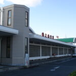
Okinoerabu Airport is small, but it has a clear public-airport-viewing anchor. Kagoshima Prefecture’s service page lists an observation deck on the rooftop of the airport terminal building. That matters because the safest first plan for aircraft watching is an official public area, not a fence line, roadside stop, or private property.
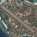
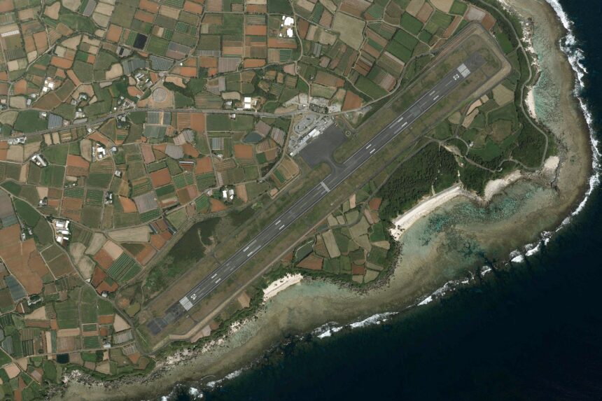
The official airport page also gives the airport its identity facts: it is managed by Kagoshima Prefecture, located in Wadomari, nicknamed Erabu Yuri no Shima Airport, and positioned near Kunigami Cape on the northern end of Okinoerabu Island. The runway is listed as 1,350m x 45m, with an apron for three propeller-aircraft positions. Treat those as airport context, not as a promise of any specific aircraft movement on your day.
Start with the rooftop observation deck
Begin at the terminal and use the official rooftop deck if aircraft viewing is your main purpose. Because the deck appears in the prefectural service listing, it is the cleanest aviation-fan anchor for a short Okinoerabu stop. Still, deck access can change because of weather, maintenance, security, events, or local operations, so check current airport information before building a long layover around it.
Keep the rest of the plan respectful and low-impact. Do not use restricted roads, service areas, fences, private land, drones, or roadside stopping to chase aircraft photos. Island roads and airport approaches are working infrastructure for residents, airport staff, emergency vehicles, and travelers.
Use terminal services before leaving
Kagoshima Prefecture’s services-provided page is the practical checklist. It lists passenger facility hours, parking usable times by season, general information, wheelchair rental through the airport building company, free wireless LAN, a nursing room near the lobby restrooms, a first-floor Sea World cafe shop, an outdoor smoking area, and the rooftop observation deck. It also lists routes to Kagoshima, Tokunoshima, and Naha, while telling travelers to check airline pages for schedules.
The airport page and services page do not use identical parking numbers: one lists airport parking capacity as 120, while the services page lists parking in front of the terminal as 130 spaces. Use that difference as a reminder not to rely on exact capacity without checking current airport guidance. The airport page also says parking is for airport users and prohibits night or outside-operation parking.
Choose one transport branch
The services page gives a simple local access benchmark: from Okinoerabu Airport to Wadomari town, about 13 minutes by taxi or 20 minutes by bus. The official tourism access page adds the bigger island-travel picture: many visitors connect through Kagoshima Airport, the Naha-Okinoerabu-Tokunoshima-Amami Oshima island-hopping route is another option, and ferry travel can be part of the plan.
Do not overpack the day. For a first visit, choose one branch after the airport: Wadomari town, ferry-port logistics, a rental-car pickup, a taxi plan, Shoryudo Cave, or Wanjo Beach. If a ferry is involved, check the port on the day because the tourism association warns that port calls can change with conditions. If a taxi or demand bus is needed, confirm reservations and availability before you depend on them.
Cave and beach add-ons
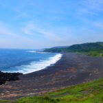
Okinoerabu Island’s official and JNTO tourism pages both frame the island around limestone caves, coral reefs, beaches, and marine activities. For a simple airport-area add-on, Shoryudo Cave is the most structured choice. The official tourism page says roughly 600m of the cave is open to general visitors, that a normal visit takes about 40 minutes, and that some areas can be slippery. It lists access as about 36 minutes by car from Okinoerabu Airport.
Wanjo Beach is the lighter outdoor branch. The official tourism page lists it as about 17 minutes by car from the airport and notes parking and accessible facilities, but it also warns snorkelers to wear life jackets and says camping requires advance permission. For aviation fans, that makes Wanjo a weather-dependent scenic add-on, not a guaranteed water-activity plan.
Accessibility and weather checks
For accessibility needs, confirm directly before travel. The services page lists wheelchair rental through the airport building company and a nursing room near the lobby restrooms, while the airport parking guidance and terminal service details should be checked before arrival. On a small island, the airport is only one part of the route: taxis, buses, rental cars, ferry ports, cave paths, beach access, and weather can decide whether the day is realistic.
Build larger buffers than you would in a major city. Rain, wind, typhoons, ferry changes, limited taxis, rental-car inventory, and attraction conditions can affect the whole day. A good Okinoerabu airport plan is not a checklist race. It is a compact aviation stop with one well-checked island branch.
Simple first-time plan
| Step | What to do | Why it works |
|---|---|---|
| 1 | Check flight status, deck access, terminal services, parking, bus, taxi, rental car, ferry port, weather, and your one island branch | Okinoerabu plans are highly timing-sensitive |
| 2 | Use the rooftop observation deck and public terminal areas first | They give the day a safe official aviation anchor |
| 3 | Choose one branch: Wadomari town, ferry logistics, Shoryudo Cave, Wanjo Beach, taxi, bus, or rental car | One branch protects your return window |
| 4 | Leave weather and transport buffers before flights, ferries, hotel transfers, cave visits, or beach time | Small-island travel needs room for disruption |
Where this fits in the transport hub
Use this as the Okinoerabu branch of the Japan Transport Fan Travel Guide. It pairs naturally with Amami, Tokunoshima, Yakushima, Ishigaki, Shimojishima, and Naha airport-area plans, but Okinoerabu stands out because its official service listing gives a rooftop observation deck and its island branches are close enough for a disciplined half-day or arrival-day plan.
Photo credit
Featured image: Okinoerabu airport aerial photograph, author listed as Geospatial Information Authority of Japan, made based on National Land Image Information (Color Aerial Photographs), Ministry of Land, Infrastructure, Transport and Tourism, via Wikimedia Commons, CC BY-SA 4.0. Cropping or resizing may be applied for site display, and resulting image derivatives remain under compatible share-alike terms. The image is used in editorial transport-travel-guide context and does not imply endorsement by MLIT, GSI, Kagoshima Prefecture, Okinoerabu Airport, airport operators, airlines, tourism organizations, Wikimedia, or the uploader.
Sources
- Kagoshima Prefecture: Okinoerabu Airport
- Kagoshima Prefecture: operating rules for Okinoerabu Airport
- Kagoshima Prefecture: services provided by Okinoerabu Airport
- Okinoerabu Island Tourism Association: access
- JNTO: Okinoerabu Island
- Official Okinoerabu Island English tourism site
- Okinoerabu Island Tourism Association: Shoryudo Cave
- Okinoerabu Island Tourism Association: Wanjo Beach
- Wikimedia Commons image file and license record
Editorial disclosure: This is an independent planning guide. It is not affiliated with Kagoshima Prefecture, MLIT, GSI, Okinoerabu Airport, Japan Air Commuter, Okinoerabu Island Tourism Association, JNTO, ferry operators, bus operators, taxi operators, rental-car companies, Shoryudo Cave operators, beach facility managers, Wikimedia, or the image uploader.