Short answer
Tsushima Airport, also branded as Tsushima Yamaneko Airport, works best as a transport-fan anchor rather than a deck-based plane-spotting stop. Use the 1,900m runway context, the mountain-airport setting, public terminal facilities, bus and taxi stops, rental-car counter, ferry-port choices, and the island’s long north-south geography to build a realistic Tsushima travel day.
Last checked: August 21, 2026. Flight operations, airline schedules, airport services, parking conditions, bus timetables, taxi availability, rental-car inventory, ferry and high-speed-boat sailings, port operations, border-route conditions, weather, sea conditions, and typhoon disruption can change. Always confirm current details on official airport, airline, ferry, city, tourism, transport, and weather pages before travel.
Why Tsushima works for transport fans
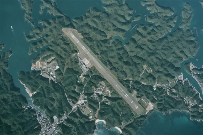
Nagasaki Prefecture describes Tsushima Airport as located around the center of Tsushima Island in Mitsushima, opened on October 10, 1975, and built by cutting into a mountain area between the Genkai Sea and Aso Bay. MLIT’s airport profile records Tsushima as a Nagasaki Prefecture-administered Class 3 airport with a 1,900m x 45m runway.
That gives the airport a strong regional-aviation story: a mountain airport on a long border island, linked by turboprop routes, port routes, buses, taxis, and rental cars. The important caution is that the official facility page does not present an observation deck. Treat this as an airport-and-island-transport day, not a rooftop viewing day. Stay in public spaces, legal roads, sidewalks, port areas, and properly used parking areas. Avoid fence-line spotting, service roads, private land, drone use, and anything that interferes with airport operations or local traffic.
Start with the terminal facts
The official facility page lists ANA and ORC check-in and baggage counters, a rental-car counter beside the arrivals-lobby exit, bus and taxi stops outside arrivals, nursing and waiting rooms, cargo handling, a second-floor shop and light food corner, TeamLab Camera, massage chairs, and passenger guidance. The FAQ adds useful details: free Wi-Fi, coin lockers, courier handling through the shop, AED, wheelchair lending, accessible toilets, stroller availability, and staff assistance because there is no elevator.
These details make the terminal useful even without an observation deck. Use it to confirm onward transport, collect a rental car, check bus or taxi movement, buy a light snack or local product, and understand the airport’s practical role on the island. If you need a specific service, verify it before travel because shop hours, facilities, airline handling, cargo rules, and assistance arrangements can change.
Connect air travel with the ports
Tsushima City says access from outside the island is by aircraft from Tsushima Yamaneko Airport and by ferry or high-speed boat from Hitakatsu and Izuhara ports. Discover Nagasaki also frames Tsushima as reachable by boat or plane, with Hakata and Busan routes appearing in the island’s sea-access story. That makes Tsushima a good place to compare air arrival, domestic ferry routes, international-route context, and long on-island movement.
Do not build tight same-day connections from old schedule memories. Use the airport site, airline pages, ferry companies, Tsushima City, and weather information close to travel. Sea conditions, wind, typhoons, port operations, and international-route status can change the plan. If you are connecting between air and sea, leave enough time for baggage, bus or taxi dispatch, rental-car pickup, road distance, and port procedures.
Choose your movement method early
Tsushima City says on-island movement is characterized by limited bus and taxi public-transport use and heavier private-car use. It also explains that National Route 382 is the main north-south route from Izuhara through town centers to Hitakatsu, while roads away from that route are often narrow, curvy, and hilly. Discover Nagasaki adds the scale: Tsushima is about 82km from north to south and about 90% mountainous.
That is why your movement decision matters more here than at many airport-area stops. A rental car is often the most flexible way to connect the airport, Izuhara, Hitakatsu, Aso Bay, viewpoints, beaches, food stops, and lodging. A bus or taxi plan can work when it is designed around current timetables, dispatch realities, cost, route length, and return movement. A cycling or walking add-on should be small, daylight-aware, and realistic about hills, tunnels, weather, and traffic.
Add one border-island branch
For a first airport-area day, choose one branch. A transport branch can connect the airport with Izuhara Port, Hitakatsu Port, or the island’s main north-south road. A scenery branch can use Aso Bay, Eboshidake Observatory, or a coastal viewpoint. A history branch can focus on castle ruins, batteries, or the island’s long role as a gateway between Japan and the Korean Peninsula.
Keep the border-island context respectful. Official tourism sources describe Tsushima as close to Korea and shaped by exchange, conflict, nature, and local culture. Avoid treating that geography as a gimmick. The better travel plan is slower: confirm transport, choose one area, protect the return window, and let the island’s scale decide the day.
Simple first-time plan
| Step | What to do | Why it works |
|---|---|---|
| 1 | Check flight status, airport notices, terminal services, parking conditions, bus timetable, taxi availability, rental-car reservation, ferry or high-speed-boat status, and weather | Tsushima plans depend on air, sea, road, and weather conditions |
| 2 | Use the public terminal, airline counters, shop, Wi-Fi, lockers, rental-car counter, bus stop, and taxi stand as the aviation anchor | The official facility page does not present an observation deck |
| 3 | Connect to Izuhara, Hitakatsu, Aso Bay, lodging, or a port by confirmed car, bus, taxi, or pickup | The airport sits near the middle of a long island |
| 4 | Add one branch: port logistics, Aso Bay scenery, Eboshidake Observatory, city food, a battery, castle remains, or a northern Korea-view route | One branch keeps the plan realistic |
| 5 | Leave buffers before flight departure, ferry sailing, rental return, bus connection, sunset, and bad-weather changes | Tsushima rewards spare time and careful routing |
Where this fits in the transport hub
Use this as the Tsushima branch of the Japan Transport Fan Travel Guide. It pairs naturally with Nagasaki, Fukue, Iki, Tanegashima, Yakushima, Amami, Kikai, Tokunoshima, Okinoerabu, Yoron, and other island-airport guides, but Tsushima stands out because the airport sits in the middle of a long border island where air, ferry, port, road, and weather planning are inseparable.
Photo credit
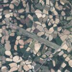
Featured image: Tsushima Airport Aerial photograph.2011, by Geospatial Information Authority of Japan, made based on National Land Image Information (Color Aerial Photographs), Ministry of Land, Infrastructure, Transport and Tourism, via Wikimedia Commons. MLIT National Land Image Information permission allows use for any purpose with proper attribution. Cropping or resizing may be applied for site display. The image is used in editorial transport-travel-guide context and does not imply endorsement by MLIT, GSI, Nagasaki Prefecture, Tsushima Airport, airport operators, airlines, ferry operators, tourism organizations, Wikimedia, or the uploader.
Sources
- Tsushima Yamaneko Airport: official site
- Tsushima Yamaneko Airport: facility information
- Tsushima Yamaneko Airport: access
- Tsushima Yamaneko Airport: FAQ
- Tsushima Yamaneko Airport: on-island transport information
- Nagasaki Prefecture: Tsushima Airport overview
- MLIT: airport profiles
- Nagasaki Prefecture: Tsushima Airport parking notice
- Tsushima City: external access
- Tsushima City: on-island movement
- Discover Nagasaki: Tsushima Island
- Wikimedia Commons image file and license record
Editorial disclosure: This is an independent planning guide. It is not affiliated with Tsushima Yamaneko Airport, Tsushima Airport Terminal Building, Nagasaki Prefecture, Tsushima City, MLIT, GSI, ANA, ORC, ferry operators, bus operators, taxi operators, rental-car companies, Discover Nagasaki, tourism organizations, Wikimedia, or the image uploader.